Android アプリ用の Android Maps API がバージョンアップしていて、ラスター画像による地図ではなく、ベクトルデータの地図が使えるようになってた。
開発者はこの新バージョンの API によって、Android 向け Google マップの数多くの最新機能を Android アプリに取り入れることができるようになります。この API を Google Play 開発者サービスの一部としてご提供できることを大変嬉しく思います。Froyo 以降 (API レベル8+) の端末に対応しています。
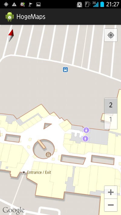
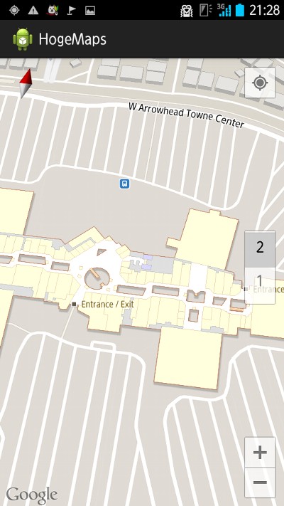
新たな API では 2D および 3D ビュー対応のベクターベースのマップを使用し、ユーザーはシンプルなジェスチャーでマップの傾斜や回転操作ができます。衛星写真やハイブリッド表示、地形や交通状況といった Google マップでおなじみの各種レイヤーに加え、新 API では主要な空港やショッピングセンターのインドア マップもアプリに追加できるようになります。
Google Maps Android API の新バージョン、Google Play開発者サービスの一部として公開 - Google Japan Developer Relations Blog
というわけで、試しにサンプルコードを書いてみる。
開発環境
- MacBook Air + Mac OS X Lion 10.7.5
- Eclipse IDE for Java Developers (Version: Juno Service Release 1)
今回の手順
- Eclipse から Android SDK Manager を起動して Google Play Services rev.4 をダウンロード
- Eclipse にて Google Play Services のライブラリ・プロジェクトを作成 (Android Project from Existing Code でプロジェクトを作成して /usr/local/android-sdks/extras/google/google_play_services/libproject/google-play-services_lib を選択してインポート)
- Google APIs Console にて、 Create Project し、 Google Maps Android API v2 を ON にし、メニューの API Access から Create new Android key にて API key を生成
- Eclipse にて、Android Application Project でプロジェクトを作成
- サンプルコードを書いて、API key を埋め込んで、ビルドして、 Android 端末実機 (Softbank ARROWS A 101F) で動作確認
サンプルのソースコード
修正したのは、メインのアクティビティクラス (MainActivity.java) と AndroidManifest.xml の2ファイルだけ。
MainActivity.java
package info.nilab.hogemaps;

import android.os.Bundle;
import android.view.Menu;
import android.support.v4.app.Fragment;
import android.support.v4.app.FragmentActivity;
import android.support.v4.app.FragmentManager;
import android.support.v4.app.FragmentTransaction;
import com.google.android.gms.maps.CameraUpdate;
import com.google.android.gms.maps.CameraUpdateFactory;
import com.google.android.gms.maps.GoogleMap;
import com.google.android.gms.maps.GoogleMapOptions;
import com.google.android.gms.maps.SupportMapFragment;
import com.google.android.gms.maps.UiSettings;
import com.google.android.gms.maps.model.CameraPosition;
import com.google.android.gms.maps.model.LatLng;

public class MainActivity extends FragmentActivity {

    private SupportMapFragment mapFragment;
    private static final String HOGE_MAP_FRAGMENT_TAG = "hoge_fragment";

    @Override
    protected void onCreate(Bundle savedInstanceState) {

        super.onCreate(savedInstanceState);
        setContentView(R.layout.activity_main);

        // 地図を表示するコードを追加
        FragmentManager fm = getSupportFragmentManager();
        Fragment f = fm.findFragmentByTag(HOGE_MAP_FRAGMENT_TAG);
        mapFragment = (SupportMapFragment)f;
        if (mapFragment == null) {

            // GoogleMapOptions
            GoogleMapOptions opt = new GoogleMapOptions();
            opt.compassEnabled(true);
            opt.rotateGesturesEnabled(true);
            opt.scrollGesturesEnabled(true);
            opt.tiltGesturesEnabled(true);

            // SupportMapFragment
            mapFragment = SupportMapFragment.newInstance(opt);

            // FragmentTransaction#add
            FragmentTransaction ft = fm.beginTransaction();
            ft.add(android.R.id.content, mapFragment, HOGE_MAP_FRAGMENT_TAG);
            ft.commit();
        }
    }

    @Override
    public boolean onCreateOptionsMenu(Menu menu) {
        // Inflate the menu; this adds items to the action bar if it is present.
        getMenuInflater().inflate(R.menu.activity_main, menu);
        return true;
    }

    @Override
    protected void onResume(){

        super.onResume();

        // GoogleMap
        GoogleMap map = mapFragment.getMap();
        map.setIndoorEnabled(true);
        map.setMapType(GoogleMap.MAP_TYPE_NORMAL);
        map.setMyLocationEnabled(true);
        map.setTrafficEnabled(true);

        // 渋谷駅: The location that the camera is pointing at.
        LatLng target = new LatLng(35.658516, 139.701773);

        // Zoom level near the center of the screen.
        float zoom = 18.0f;

        // The angle, in degrees, of the camera angle from the nadir (directly facing the Earth).
        //
        // CameraPosition.Builder | Android Developers
        // http://developer.android.com/reference/com/google/android/gms/maps/model/CameraPosition.Builder.html#tilt(float)
        //
        // Sets the angle, in degrees, of the camera from the nadir (directly facing the Earth).
        // When changing the camera position for a map, this value is restricted depending on the zoom level of the camera. The restrictions are as follows:
        // - For zoom levels less than 10 the maximum is 30.
        // - For zoom levels from 10 to 14 the maximum increases linearly from 30 to 45 (e.g. at zoom level 12, the maximum is 37.5).
        // - For zoom levels from 14 to 15.5 the maximum increases linearly from 45 to 67.5.
        // - For zoom levels greater than 15.5 the maximum is 67.5.
        // The minimum is always 0 (directly down). If you specify a value outside this range and try to move the camera to this camera position it will be clamped to these bounds.
        float tilt = 90.0f; // 0.0 - 90.0

        // Direction that the camera is pointing in, in degrees clockwise from north.
        float bearing = 0.0f;

        // CameraUpdate
        CameraPosition pos = new CameraPosition(target, zoom, tilt, bearing);
        CameraUpdate camera = CameraUpdateFactory.newCameraPosition(pos);

        map.moveCamera(camera);

        // UiSettings
        UiSettings ui = map.getUiSettings();
        ui.setZoomControlsEnabled(true);
        ui.setZoomGesturesEnabled(true);
    }

}
AndroidManifest.xml
<?xml version="1.0" encoding="utf-8"?>
<manifest xmlns:android="http://schemas.android.com/apk/res/android"
    package="info.nilab.hogemaps"
    android:versionCode="1"
    android:versionName="1.0" >

    <uses-sdk
        android:minSdkVersion="15"
        android:targetSdkVersion="15" />

    // Adding the API Key to your application - Google Maps Android API v2 — Google Developers
    // https://developers.google.com/maps/documentation/android/start#adding_the_api_key_to_your_application
    <permission
        android:name="info.nilab.hogemaps.permission.MAPS_RECEIVE"
        android:protectionLevel="signature"/>
    <uses-permission android:name="info.nilab.hogemaps.permission.MAPS_RECEIVE"/>

    // Specify settings in the Application Manifest - Google Maps Android API v2 — Google Developers
    // https://developers.google.com/maps/documentation/android/start#specify_settings_in_the_application_manifest
    <uses-permission android:name="android.permission.INTERNET"/>
    <uses-permission android:name="android.permission.WRITE_EXTERNAL_STORAGE"/>
    <uses-permission android:name="com.google.android.providers.gsf.permission.READ_GSERVICES"/>
    <uses-permission android:name="android.permission.ACCESS_COARSE_LOCATION"/>
    <uses-permission android:name="android.permission.ACCESS_FINE_LOCATION"/>
    <uses-feature
        android:glEsVersion="0x00020000"
        android:required="true"/>

    <application
        android:allowBackup="true"
        android:icon="@drawable/ic_launcher"
        android:label="@string/app_name"
        android:theme="@style/AppTheme" >

    // Adding the API Key to your application - Google Maps Android API v2 — Google Developers
    // https://developers.google.com/maps/documentation/android/start#adding_the_api_key_to_your_application
    //
    // Google APIs Console https://code.google.com/apis/console/ で作った
    // API key (Key for Android apps) を記述
    <meta-data
        android:name="com.google.android.maps.v2.API_KEY"
            android:value="abcdefghijklmnopqrstuvxyzABCDEFGH123456" />

        <activity
            android:name="info.nilab.hogemaps.MainActivity"
            android:label="@string/app_name" >
            <intent-filter>
                <action android:name="android.intent.action.MAIN" />

                <category android:name="android.intent.category.LAUNCHER" />
            </intent-filter>
        </activity>
    </application>

</manifest>
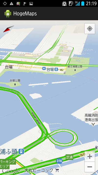
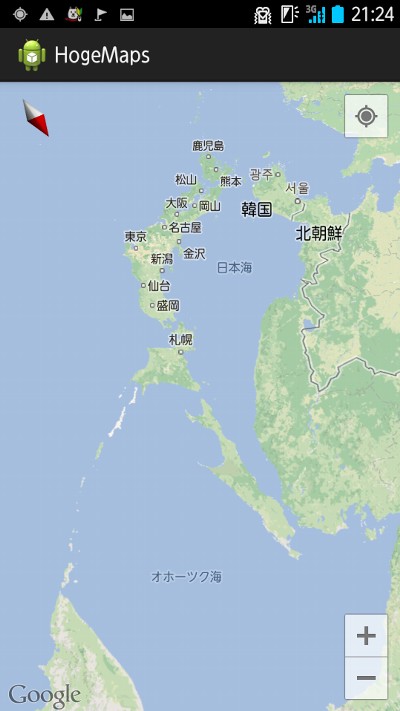
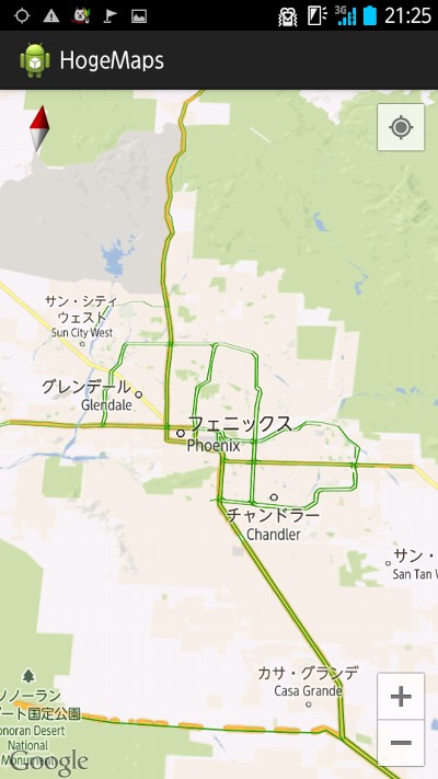
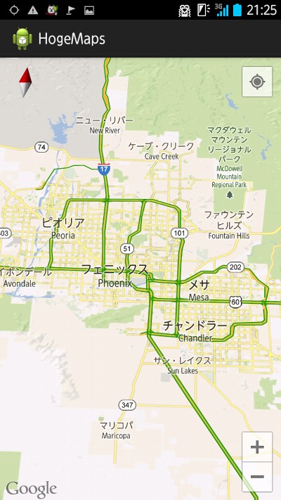
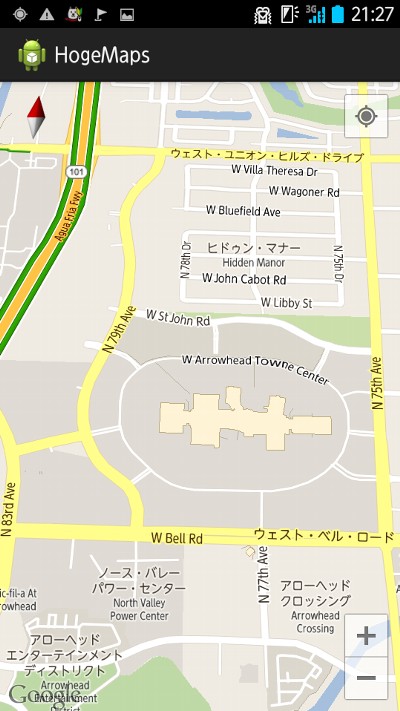
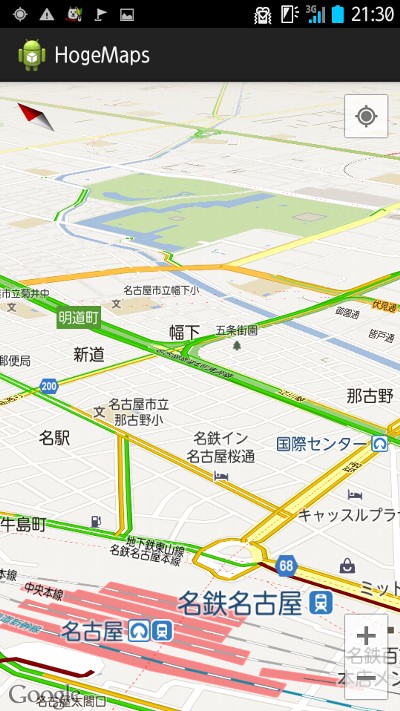
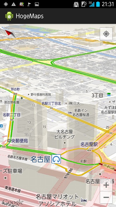
サンプルコードによる Android アプリのスクリーンショット
ベクトルならではの3D俯瞰とインドアマップ機能など。
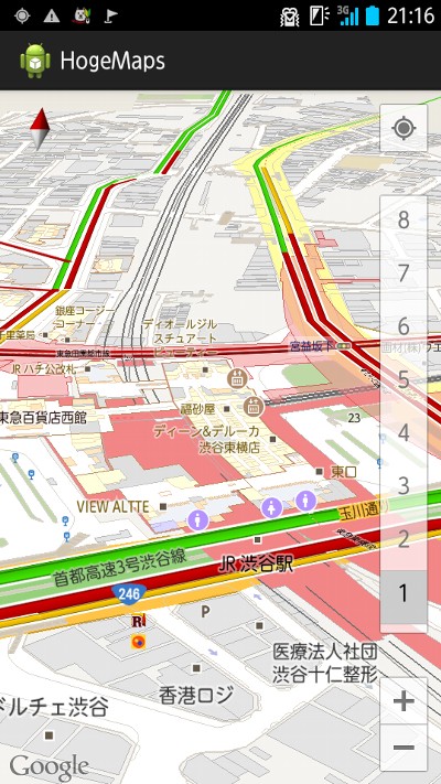
渋谷駅。
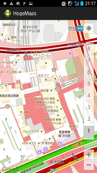
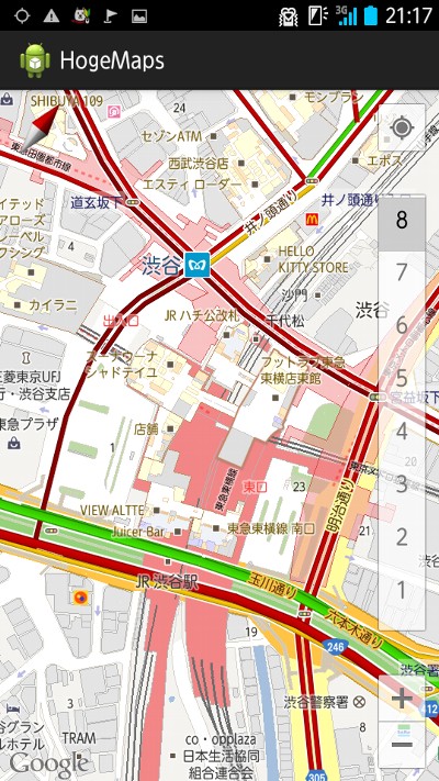
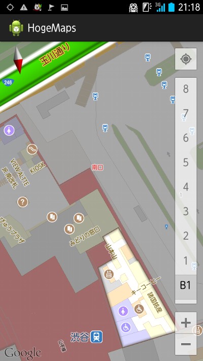
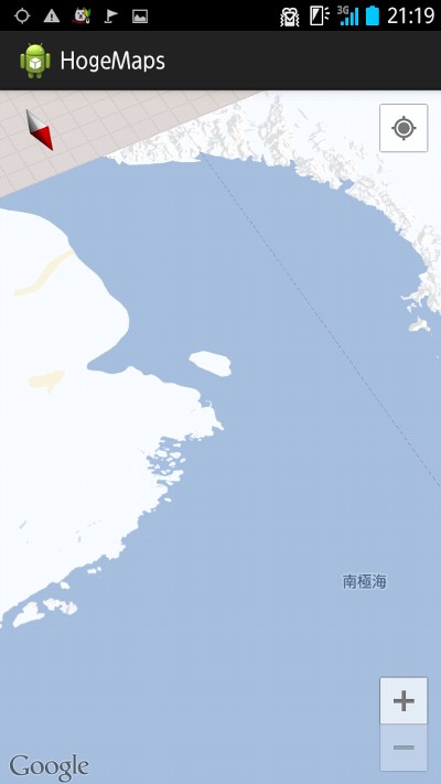
南極大陸の先は無し。
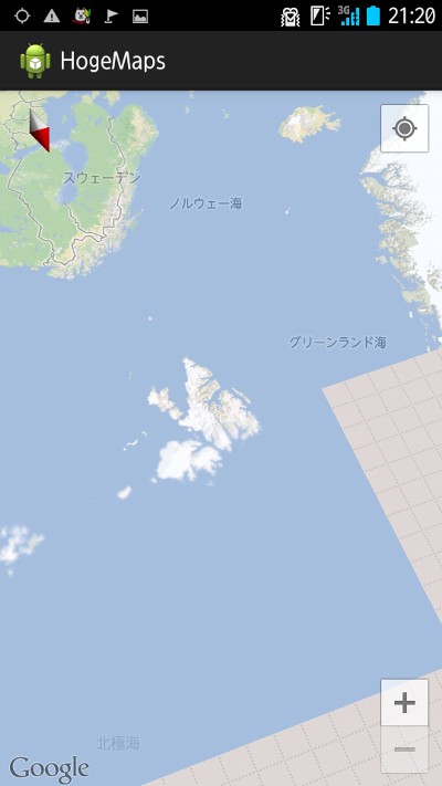
素早くドラッグすると読み込むのが追いつかずに灰色に。
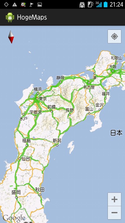
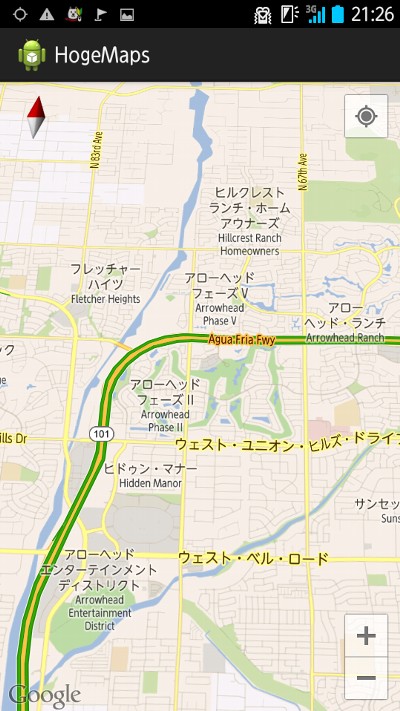
アローヘッド タウン センター (Arrowhead Towne Center)。
名古屋駅。
Ref.
- Google Maps Android API v2 — Google Developers
- Android Developers Blog: New Google Maps Android API now part of Google Play services
- Google Maps Android API の新バージョン、Google Play開発者サービスの一部として公開 - Google Japan Developer Relations Blog
- Package Index | Android Developers
- Google Maps Android API v2 導入の仕方 - 戌印-INUJIRUSHI- (Androidあれこれ) -
- Google Maps Android API v2 試してみた - 戌印-INUJIRUSHI- (Androidあれこれ) -
- MapFragment を動的に実装する - 戌印-INUJIRUSHI- (Androidあれこれ) -
- throw Life - Google Maps Android API v2を使ってみた
tags: google_maps_api android
Posted by NI-Lab. (@nilab)


