ここでいう2.5次元はこれ↓
2.5次元(にてんごじげん)は、物体の3次元的形状を、1つの方向から見える範囲で表したもの。2次元と3次元の中間という意味でこう呼ばれる。ただし、端数の0.5という値に正確な意味合いがあるわけではない。
2.5次元 - Wikipedia
アニメ漫画ゲームを2次元として、現実(の異性)を3次元とするとき、その中間を2.5次元とすることが多いです。検索してもずばりこれという説明がなかった*1ので説明すると、2.5次元とはフィギュアやコスプレ、声優にプラモデルなど、2次元的要素を持った3次元、あるいは3次元要素を持った2次元のもののことを指します。
2.5次元は2種類ある - 遥か彼方の彼方から
↑こっちは別物。
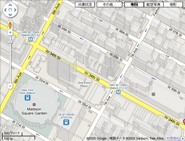
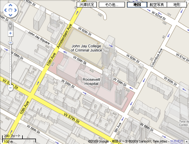
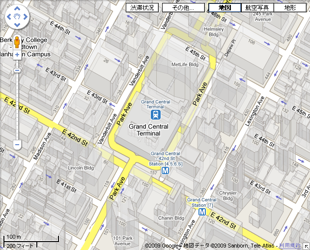
Google Maps のアメリカの地図の一部で、建物が半透明で立体的に描かれている。
Madison Square Garden 付近
Roosevelt Hospital 付近
Grand Central Terminal 付近
ズームレベルの広域表示のほうから順番に見ていくと、
ペラペラの平面地図 -> 建物が立体 -> 建物が立体で半透明
と変化していく。
zoom level = 15
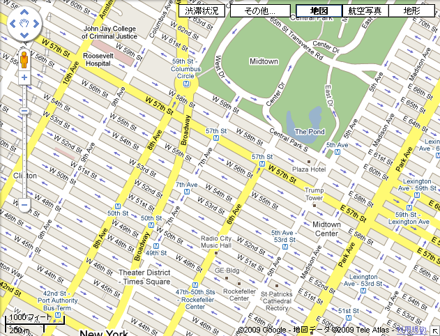
zoom level = 16
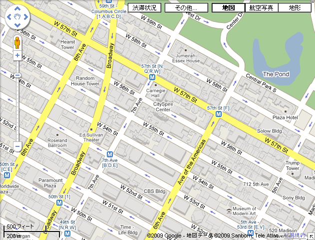
zoom level = 17
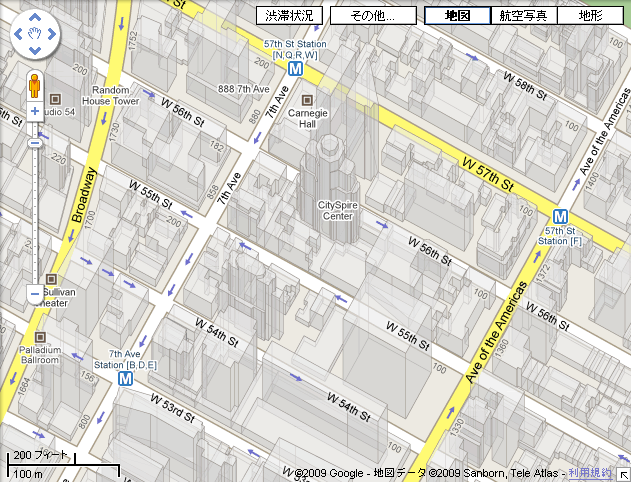
zoom level = 18
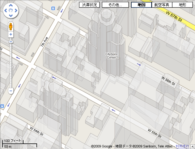
zoom level = 19
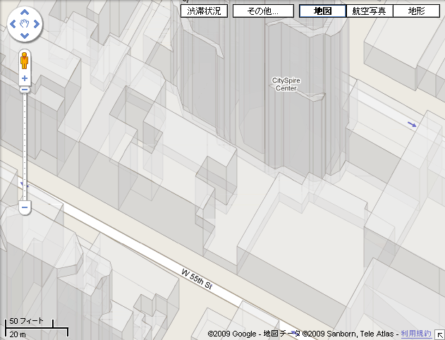
↓アメリカの38箇所ぐらいの都市がこの半透明&立体表示になっているらしい(2007年4月の情報)。
The update has been applied to approximately 38 US cities, so get on Google Maps, zoom right down onto levels 1 and 2 and take a look around! While you're there why not create a "My Maps"mashup of historical buildings or your favorite building architecture with your own photos or digital video to add some life to these new 2.5D buildings?!
Google Maps Mania: Google Maps adds 2.5D Buildings and Structures
Ref.
-Google Maps Mania: Google Maps adds 2.5D Buildings and Structures
-Google Mapsの"2.5次元地図"は、拡大すると新鮮な驚きが:MarkeZine(マーケジン)
-Google Maps - CitySpire Center 付近の地図
-[ヅラド] Google Maps がビル名などを建物形状内に配置するように&建物の立体表示も (日本の建物立体表示)
tags: zlashdot GIS GoogleMaps
Posted by NI-Lab. (@nilab)


