ただし、ツイート (つぶやき, status) から取得できる位置情報に限る (プロフィールの位置情報は今回扱わない)。
ツイートは Twitter API の
http://api.twitter.com/1/statuses/user_timeline.json?screen_name=nilab&trim_user=true
にて取得している。
Ref. GET statuses/user_timeline | Twitter Developers
ツイートから取得できる位置情報は3種類
ツイート (APIリファレンスによるとstatusと呼ばれる) に含まれる位置情報は以下の3種類。
- coordinates: 経度・緯度
- geo: 緯度・経度
- place: Twitterが管理する場所データベースのエントリ
coordinates オブジェクト
coordinates に経度、緯度の順番 (GeoJSON形式) で位置情報が格納されている。
"coordinates": {
  "type": "Point",
  "coordinates": [
    136.88562512,
    35.17593059
  ]
}
geo オブジェクト
緯度、経度 (前述のcoordinatesオブジェクトとは逆の順番) の順番で位置情報が格納されている。
"geo": {
  "type": "Point",
  "coordinates": [
    35.17593059,
    136.88562512
  ]
}
place オブジェクト
Twitterが管理する場所データベースのエントリが格納されている。
複数の経度・緯度を持つポリゴン形状となっていて、場所の名称や属する国の情報なども含まれている。
"place": {
  "name": "Nagoya City Nishi Ward",
  "country_code": "JP",
  "attributes": {},
  "full_name": "Nagoya City Nishi Ward, Aichi",
  "url": "http://api.twitter.com/1/geo/id/6169466efdfafa79.json",
  "bounding_box": {
    "type": "Polygon",
    "coordinates": [
      [
        [
          136.855966666667,
          35.1709238888889
        ],
        [
          136.908068888889,
          35.1709238888889
        ],
        [
          136.908068888889,
          35.2345627777778
        ],
        [
          136.855966666667,
          35.2345627777778
        ]
      ]
    ]
  },
  "place_type": "city",
  "country": "Japan",
  "id": "6169466efdfafa79"
}
coordinates と geo の値が同じ
自分がいままで見たデータの中には、coordinates オブジェクトと geo オブジェクトの値は緯度と経度の順序が違うだけで、中身は同じものしか見つからなかった。
勝手な推測をするなら、もしかして Twitter API には geo オブジェクトが先に存在していてこれはGeoJSONのフォーマットで規定されている緯度・経度の順序と異なるため、順序を変更しただけの coordinates オブジェクトを用意したのではないだろうか。互換性のため geo オブジェクトはそのままで。
いろいろなクライアントで投稿した位置情報付きツイートの状況
| Twitter クライアント | coordinates の有無 | geo の有無 | place の有無 |
|---|---|---|---|
| PC + twitter.com (サイト) | × | × | ○ |
| iPhone + mobile.twitter.com (サイト) | ○ | ○ | ○ |
| iPhone + Echofon (アプリ) | × | × | ○ |
| iPhone + foursquare (アプリ) | ○ | ○ | ○ |
| iPhone + nilogger (自作アプリ) | ○ | ○ | ○ |
nilogger (自作 iPhone アプリ) ではツイートする際に lat, long パラメータを付加して投稿している。調査した結果からすると、 lat, long は coordinates, geo オブジェクトにセットされ、それだけでなく place オブジェクトにも Twitter サイト側で自動的に情報がセットされるようだ。
以下に、それぞれのクライアントによる位置情報付きツイート(status)のJSONデータを列挙する。
PC + twitter.com (サイト)
| coordinates | geo | place | |
|---|---|---|---|
| PC + twitter.com (サイト) | × | × | ○ |
{
  "in_reply_to_screen_name": null,
  "place": {
    "name": "Nagoya City Naka Ward",
    "country_code": "JP",
    "attributes": {},
    "full_name": "Nagoya City Naka Ward, Aichi",
    "url": "http://api.twitter.com/1/geo/id/b65f8a1a90e649ad.json",
    "bounding_box": {
      "type": "Polygon",
      "coordinates": [
        [
          [
            136.891989166667,
            35.1426647222222
          ],
          [
            136.929841666667,
            35.1426647222222
          ],
          [
            136.929841666667,
            35.1872666666667
          ],
          [
            136.891989166667,
            35.1872666666667
          ]
        ]
      ]
    },
    "place_type": "city",
    "country": "Japan",
    "id": "b65f8a1a90e649ad"
  },
  "favorited": false,
  "id_str": "183017400109776898",
  "geo": null,
  "user": {
    "id_str": "5704532",
    "id": 5704532
  },
  "in_reply_to_status_id": null,
  "in_reply_to_status_id_str": null,
  "retweet_count": 0,
  "retweeted": false,
  "truncated": false,
  "in_reply_to_user_id_str": null,
  "coordinates": null,
  "source": "web",
  "created_at": "Fri Mar 23 02:28:43 +0000 2012",
  "contributors": null,
  "id": 183017400109776900,
  "in_reply_to_user_id": null,
  "text": "名古屋市中区みたいな。"
}
placeオブジェクトの経度緯度ポリゴンを地図上に展開するとこんな感じ。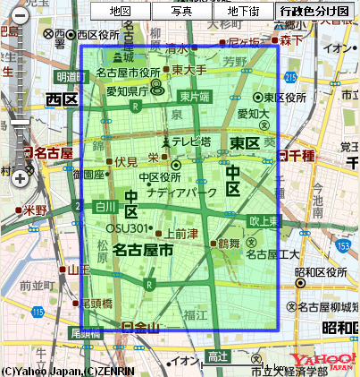

⇒ Twitter / @nilab: 名古屋市中区みたいな。 ...
ツイートの「from Nagoya City Naka Ward, Aichi」のところが https://twitter.com/#!/places/b65f8a1a90e649ad へのリンクになっていて、そのまま、
Nagoya City Naka Ward, Aichi, Japan - Google マップ へリダイレクトされる。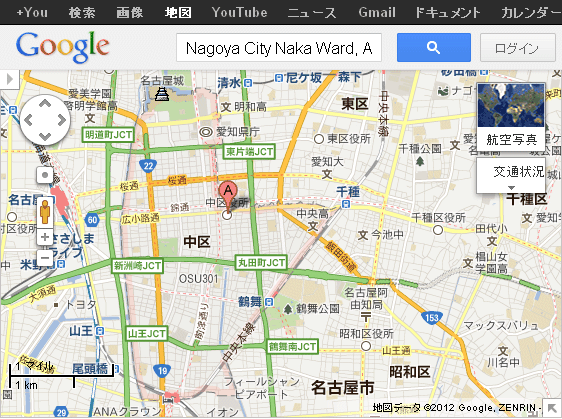
iPhone 4S + mobile.twitter.com (サイト)
| coordinates | geo | place | |
|---|---|---|---|
| iPhone + mobile.twitter.com (サイト) | ○ | ○ | ○ |
{
  "in_reply_to_screen_name": null,
  "place": {
    "name": "Nagoya City Nishi Ward",
    "country_code": "JP",
    "attributes": {},
    "full_name": "Nagoya City Nishi Ward, Aichi",
    "url": "http://api.twitter.com/1/geo/id/6169466efdfafa79.json",
    "bounding_box": {
      "type": "Polygon",
      "coordinates": [
        [
          [
            136.855966666667,
            35.1709238888889
          ],
          [
            136.908068888889,
            35.1709238888889
          ],
          [
            136.908068888889,
            35.2345627777778
          ],
          [
            136.855966666667,
            35.2345627777778
          ]
        ]
      ]
    },
    "place_type": "city",
    "country": "Japan",
    "id": "6169466efdfafa79"
  },
  "favorited": false,
  "id_str": "183026841001537537",
  "geo": {
    "type": "Point",
    "coordinates": [
      35.17521286,
      136.88532751
    ]
  },
  "user": {
    "id_str": "5704532",
    "id": 5704532
  },
  "in_reply_to_status_id": null,
  "in_reply_to_status_id_str": null,
  "retweet_count": 0,
  "retweeted": false,
  "truncated": false,
  "in_reply_to_user_id_str": null,
  "coordinates": {
    "type": "Point",
    "coordinates": [
      136.88532751,
      35.17521286
    ]
  },
  "source": "<a href=\"http://mobile.twitter.com\" rel=\"nofollow\">Mobile Web</a>",
  "created_at": "Fri Mar 23 03:06:14 +0000 2012",
  "contributors": null,
  "id": 183026841001537540,
  "in_reply_to_user_id": null,
  "text": "おなかすいた"
}
placeオブジェクトの経度緯度ポリゴンとcoordinates/geoオブジェクトをアイコンとして地図上に展開するとこんな感じ。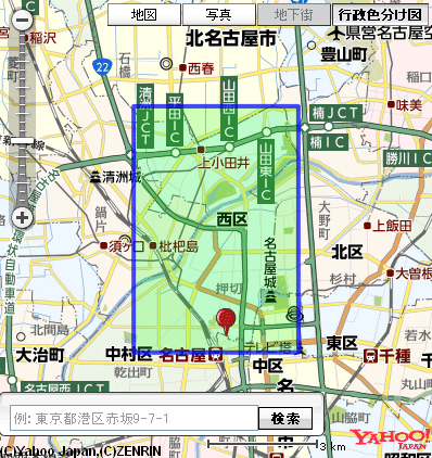
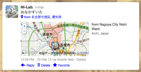
⇒ Twitter / @nilab: おなかすいた ...
iPhone 4S + Echofon (アプリ)
Echofon Pro for Twitter version 5.1.5 を使用。
| coordinates | geo | place | |
|---|---|---|---|
| iPhone + Echofon (アプリ) | × | × | ○ |
{
  "in_reply_to_screen_name": null,
  "place": {
    "name": "Nagoya City Nishi Ward",
    "country_code": "JP",
    "attributes": {},
    "full_name": "Nagoya City Nishi Ward, Aichi",
    "url": "http://api.twitter.com/1/geo/id/6169466efdfafa79.json",
    "bounding_box": {
      "type": "Polygon",
      "coordinates": [
        [
          [
            136.855966666667,
            35.1709238888889
          ],
          [
            136.908068888889,
            35.1709238888889
          ],
          [
            136.908068888889,
            35.2345627777778
          ],
          [
            136.855966666667,
            35.2345627777778
          ]
        ]
      ]
    },
    "place_type": "city",
    "country": "Japan",
    "id": "6169466efdfafa79"
  },
  "favorited": false,
  "id_str": "183027206631596032",
  "geo": null,
  "user": {
    "id_str": "5704532",
    "id": 5704532
  },
  "in_reply_to_status_id": null,
  "in_reply_to_status_id_str": null,
  "retweet_count": 0,
  "retweeted": false,
  "truncated": false,
  "in_reply_to_user_id_str": null,
  "coordinates": null,
  "source": "<a href=\"http://www.echofon.com/\" rel=\"nofollow\">Echofon</a>",
  "created_at": "Fri Mar 23 03:07:41 +0000 2012",
  "contributors": null,
  "id": 183027206631596030,
  "in_reply_to_user_id": null,
  "text": "はらへ #harahe"
}
placeオブジェクトの経度緯度ポリゴンを地図上に展開するとこんな感じ。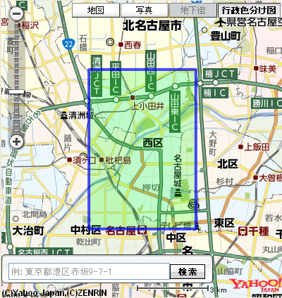
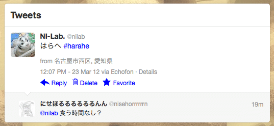
⇒ Twitter / @nilab: はらへ #harahe ...
iPhone 4S + foursquare (アプリ)
| coordinates | geo | place | |
|---|---|---|---|
| iPhone + foursquare (アプリ) | ○ | ○ | ○ |
{
  "in_reply_to_screen_name": null,
  "place": {
    "name": "Nagoya City Nishi Ward",
    "country_code": "JP",
    "attributes": {},
    "full_name": "Nagoya City Nishi Ward, Aichi",
    "url": "http://api.twitter.com/1/geo/id/6169466efdfafa79.json",
    "bounding_box": {
      "type": "Polygon",
      "coordinates": [
        [
          [
            136.855966666667,
            35.1709238888889
          ],
          [
            136.908068888889,
            35.1709238888889
          ],
          [
            136.908068888889,
            35.2345627777778
          ],
          [
            136.855966666667,
            35.2345627777778
          ]
        ]
      ]
    },
    "place_type": "city",
    "country": "Japan",
    "id": "6169466efdfafa79"
  },
  "favorited": false,
  "id_str": "183023361012678656",
  "possibly_sensitive": false,
  "geo": {
    "type": "Point",
    "coordinates": [
      35.17593059,
      136.88562512
    ]
  },
  "user": {
    "id_str": "5704532",
    "id": 5704532
  },
  "in_reply_to_status_id": null,
  "in_reply_to_status_id_str": null,
  "retweet_count": 0,
  "retweeted": false,
  "truncated": false,
  "in_reply_to_user_id_str": null,
  "coordinates": {
    "type": "Point",
    "coordinates": [
      136.88562512,
      35.17593059
    ]
  },
  "source": "<a href=\"http://foursquare.com\" rel=\"nofollow\">foursquare</a>",
  "created_at": "Fri Mar 23 02:52:24 +0000 2012",
  "contributors": null,
  "id": 183023361012678660,
  "in_reply_to_user_id": null,
  "text": "I'm at デイリーヤマザキ 名古屋Pセントラル店 (名古屋市, 愛知県) http://t.co/jbkHfEut"
}
placeオブジェクトの経度緯度ポリゴンとcoordinates/geoオブジェクトをアイコンとして地図上に展開するとこんな感じ。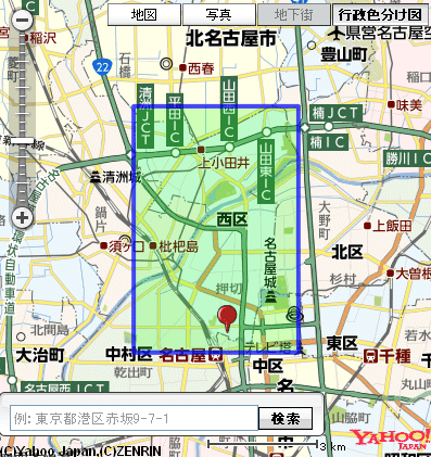
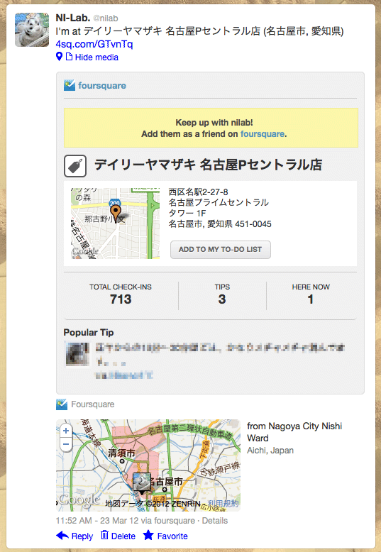
⇒ Twitter / @nilab: I'm at デイリーヤマザキ 名古屋Pセントラル店 ...
iPhone 4S + nilogger (自作アプリ)
nilogger (自作 iPhone アプリ) ではツイートする際に lat, long パラメータを付加して投稿している。 place_id は付加していないが、投稿後に Twitter API で取得すると place オブジェクトも存在していた。
| coordinates | geo | place | |
|---|---|---|---|
| iPhone + nilogger (自作アプリ) | ○ | ○ | ○ |
{
  "in_reply_to_screen_name": null,
  "place": {
    "name": "小牧市",
    "country_code": "JP",
    "attributes": {},
    "full_name": "小牧市, 愛知県",
    "url": "http://api.twitter.com/1/geo/id/393fdb830543dade.json",
    "bounding_box": {
      "type": "Polygon",
      "coordinates": [
        [
          [
            136.881159722222,
            35.2554238888889
          ],
          [
            137.045684722222,
            35.2554238888889
          ],
          [
            137.045684722222,
            35.3389138888889
          ],
          [
            136.881159722222,
            35.3389138888889
          ]
        ]
      ]
    },
    "place_type": "city",
    "country": "日本",
    "id": "393fdb830543dade"
  },
  "favorited": false,
  "id_str": "183436331651833856",
  "geo": {
    "type": "Point",
    "coordinates": [
      35.27991972,
      136.91789
    ]
  },
  "user": {
    "id_str": "5704532",
    "id": 5704532
  },
  "in_reply_to_status_id": null,
  "in_reply_to_status_id_str": null,
  "retweet_count": 0,
  "retweeted": false,
  "truncated": false,
  "in_reply_to_user_id_str": null,
  "coordinates": {
    "type": "Point",
    "coordinates": [
      136.91789,
      35.27991972
    ]
  },
  "source": "<a href=\"http://www.nilab.info/lab/nilogger/\" rel=\"nofollow\">nilogger</a>",
  "created_at": "Sat Mar 24 06:13:24 +0000 2012",
  "contributors": null,
  "id": 183436331651833860,
  "in_reply_to_user_id": null,
  "text": "てstφ(゚ω゚=) \nほっかほっか亭常普請店 \n住所: 愛知県小牧市郷中1丁目29 \nTEL: 0568-76-4147 \nL:35.279919722222,136.917890000000"
},
placeオブジェクトの経度緯度ポリゴンとcoordinates/geoオブジェクトをアイコンとして地図上に展開するとこんな感じ。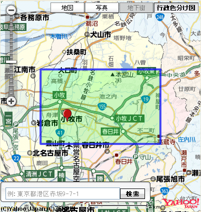
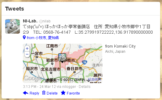
⇒ Twitter / @nilab: てstφ(゚ω゚=) ほっかほっか亭常普請店 住 ...
「from Komaki City」のところがリンクになっていて、直接 http://maps.google.com/maps?q=Komaki+City%2C+Aichi%2C+Japan にリンクされている。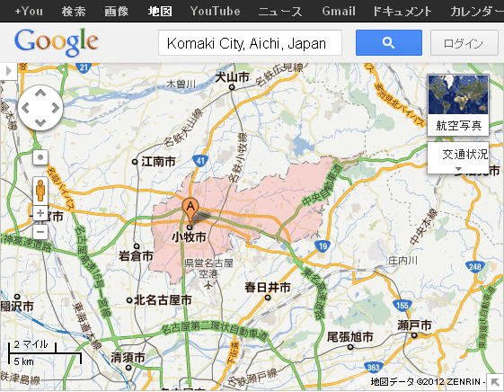
こちらは PC + twitter.com から投稿したときのように https://twitter.com/#!/places/ 経由でリダイレクトされるようにはなっていない。
参考資料
Ref.
- Twitter API ポケットリファレンス (Book477414732X - MemoWiki) ← この書籍がすごく参考になった。日本語できれいにまとまっている良書。
- GET statuses/show/:id | Twitter Developers
- GET statuses/user_timeline | Twitter Developers
- POST statuses/update | Twitter Developers
- Geo Developer Guidelines | Twitter Developers
その他
地図上にポリゴンやアイコンを表示するのには Features View を使用。
tags: twitter location
Posted by NI-Lab. (@nilab)


