GeoPDF や geospatial PDF というのは地理的な位置情報 (緯度とか経度とか) を持っているPDFらしい。
その GeoPDF や geospatial PDF を閲覧できる iPhone アプリ (iPad や iPod touchでも可) Avenza PDF Maps をインストールしてみた。
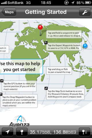
地図は無料でダウンロードできるものが用意されてる。
って、アジア地域の無いし!
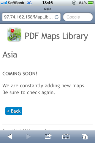
別のカテゴリーで探してみたらあった。京都だけしかないけど。
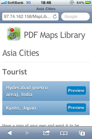
観光マップっぽい雰囲気。
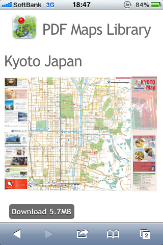
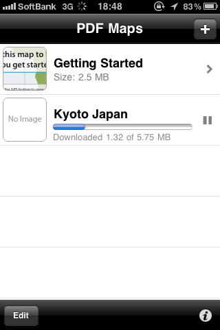
ダウンロードしてここに貯めこんでおける。
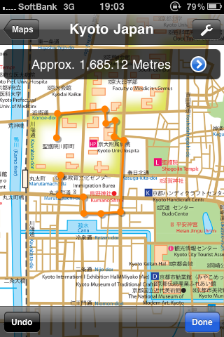
京都の地図上で距離を測ってみたり。
タップして経路を書くと距離がわかる。
キョリ測 とか yubichiz みたい。
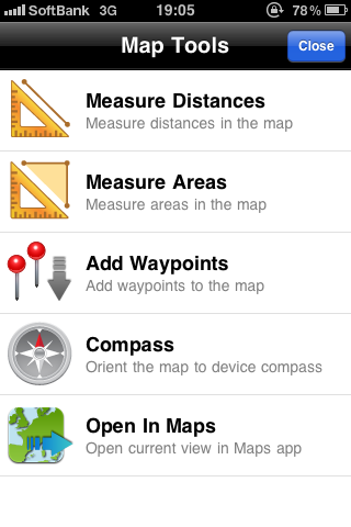
他にも機能がいろいろ。
In the past few years, Apple has sold over 90 million iOS devices worldwide. Avenza Systems is making mobile GIS technology available onto these devices for everybody to use.
The PDF Maps app is a geospatial PDF reader for your Apple iPhone, iPad and iPod Touch devices. It compliments MAPublisher and Geographic Imager, both of which have the ability to export geospatial PDF. Geospatial PDF export is also supported by some common GIS applications including ArcGIS. This means that you can use your Apple iOS device to:
* Access and load maps over a Wi-Fi or cellular network to read any time
* Access and load maps from your own computer through iTunes File Sharing
* Access and interact with saved maps without the need for a live network connection (offline)
* Download content from the PDF Maps Library including 1:24,000 scale USGS topographic maps for the entire United States
* View your location on the PDF map using the built-in GPS device (iPad and iPhone)
* Use the compass to view true or magnetic north (iPad and iPhone)
* Quickly view, zoom and pan maps using gestures (pinch, drag and flick, double tap)
* Plot waypoints, change pin colors, position and label names, enter attribute data and notes
* Export waypoints and associated attribute data to CSV, GPX or KML
* View the coordinates of the current position and any waypoint (latitude and longitude) and open it in the Maps app
* Measure distances and areas
* Open current map extents in the Maps app
PDF Maps can be used by companies, organizations and individuals who wish to share geographic information and knowledge.
PDF Maps iOS App | Avenza Systems Inc
Toronto, ON, September 28, 2010 - Avenza Systems Inc., producers of MAPublisher cartographic software for Adobe Illustrator and Geographic Imager spatial tools for Adobe Photoshop, is pleased to announce the official release of PDF Maps, the first and only geospatial PDF reader for Apple iOS devices including the iPhone, iPad, and iPod Touch.
(中略)
PDF Maps offers the following capabilities
• Access and load maps from your own computer through iTunes File Sharing as well as over the Internet or a LAN
• Access and interact with saved maps without the need for a live network connection
• View your location on the PDF map using the built-in GPS device (iPhone and iPad 3G+WiFi) or via Wi-Fi triangulation
• Use the compass to view true or magnetic north (iPhone and iPad 3G+WiFi)
• Quickly view, zoom and pan maps using gestures (pinch, drag and flick, double tap)
• Plot way-points, enter attribute data and notes
• Display the location of any point (latitude and longitude)
• Measure distances and areas
• Supports both Adobe geospatial PDF specified maps and GeoPDF files
Avenza PDF Maps App for Apple iOS Released
Adobeの資料によると「geospatial PDF」の日本語訳は「地図情報 PDF」らしい。
地図情報 PDF には、地理的な位置を参照するために必要な情報が含まれています。地図情報を PDF 内に読み込むと、その地図座標が Acrobat に保持されます。この座標を使用して、PDF を表示および操作して位置データを検索し、マークすることができます。
地図情報のデータは、ベクトルベースまたはラスターベース、あるいは両方の組み合わせとすることができます。Acrobat 内に読み込んだ地図情報のデータは、次のような様々な用途に使用できます。
* 位置座標の検索とマーク付け
* 距離、周辺、面積の測定
* 座標系と測定単位の変更
* クリップボードにコピーした位置座標に基づく Web マッピングサービスでの位置の表示
* ラスター画像の登録による地図情報対応 PDF の作成
Adobe Acrobat 9 Standard * 地図情報 PDF について
A geospatial PDF contains information that is required to georeference location data. When geospatial data is imported into a PDF, Acrobat retains the geospatial coordinates. With the coordinates, you can view and interact with the PDF to find and mark location data.
Geospatial data can be either vector or raster based or a combination of both. After you import geospatial data into Acrobat, you can use the data in a variety of ways:
* Find and mark location coordinates.
* Measure distance, perimeter, and area.
* Change the coordinate system and measurement units.
* Copy location coordinates to the clipboard, and then use them to show locations in several web mapping services.
* Register a raster image to create a geospatially aware PDF.
Adobe Acrobat 9 Standard * About geospatial PDFs
GeoPDFのほうはいまいちよくわからないなぁ。
GeoPDF refers to map and imagery products created by TerraGo software applications. GeoPDF products use geospatial PDF as a container for maps, imagery, and other data used to deliver an enhanced user experience in TerraGo applications. However, GeoPDF products conform to published specifications including both the OGC best practice for PDF georegistration as well as Adobe's proposed geospatial extensions to ISO 32000, making them consumable by applications such as Adobe Acrobat, Adobe Reader, Global Mapper, and others. GeoPDF products often include other advanced PDF features such as layers and object data which can add significant GIS functionality to the file, particularly when used with the TerraGo Technologies plugin to Adobe Reader or other TerraGo clients.
GeoPDF - Wikipedia, the free encyclopedia
Geospatial PDF refers to the Portable Document Format (PDF) and certain geospatial extensions thereto that relate a region on a PDF document page to a region in physical space. The establishment of this relationship is a process of georeferencing. The georeferencing metadata for geospatial PDF is most commonly encoded in one of two ways: the OGC best practice and as Adobe's proposed geospatial extensions to ISO 32000.
Features commonly associated with geospatial PDF are simply features of PDF:
* the ability to graphically represent vector and raster information (content and imaging model PDF 1.0)
* the separation of graphics content into different layers (optional content PDF 1.5)
* the association of tabular information with graphical features (user properties PDF 1.6)
However, in combination with the georeferencing metadata, geospatial PDF is a compelling mechanism for the dissemination of geospatial information and intelligence.
Implementation of the georeferencing of PDF files was pioneered by TerraGo Technologies in the development of their GeoPDF-branded map and imagery products produced from their software applications. GeoPDF products originally used the OGC best practice to encode the georeferencing metadata, but after the release of the Adobe extensions may contain either the Adobe or OGC encodings.
(中略)
The geospatial PDF described here should not be confused with GeoPDF, a trademark used to brand geospatial PDF files created by TerraGo software. There are no restrictions for using either the OGC best practice or Adobe's proposed geospatial extensions to ISO 32000 to create applications which consume or produce geospatial PDF files. Adobe Acrobat and Reader support consumption of both of these georeferencing encodings. Adobe specified geospatial PDF files and Terrago GeoPDF files although similar in principal are not the same thing and are not created in the same manner.
Geospatial PDF - Wikipedia, the free encyclopedia
Ref.
-PDF Maps iOS App | Avenza Systems Inc
-PDF Maps Support | Avenza Systems Inc
-Avenza PDF Maps for iPhone, iPod touch, and iPad on the iTunes App Store
tags: Pdf iPhone zurazure
Posted by NI-Lab. (@nilab)


