| 関連するかも情報 |
|---|
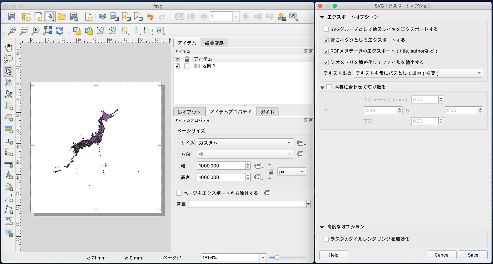
QGIS で SVG のエクスポートはできないと思ってたけどレイアウトという機能を使ったらできた(∩´∀`)∩ワーイ
でも細かいIDは振れなさそう・・・ 元のデータをいじるしかないのかな。 https://twitter.com/nilab/status/1313065704271171584/photo/1

元の画像を見る
[t] 2020-10-05 19:37:14
|
なにこれ(=゚ω゚)ノニャーン♪
「人間を猫に変えてしまうN・Nウイルスによりパンデミックが発生。人類は猫に襲われ、次々と猫になってしまう」
ニャイト・オブ・ザ・リビングキャット - 原作:ホークマン/作画:メカルーツ / 第1話「すべてが猫になる」 https://magcomi.com/episode/13933686331715261669
[t] 2020-10-05 20:17:01
|
RT @oosakitakaneko:
新連載始まりました!1話ここから読めます!
ねこですよろしくおねがいします
https://magcomi.com/episode/13933686331715261669
[t] 2020-10-05 20:17:12
|
【話題のキーワード】
1. 自己防衛おじさん
2. Gmail
3. 付録
4. エアアジア
5. えび
6. 真鳥
7. まふまふ
8. 大山
9. PG12
10. 煉獄零巻
11. 虎者
https://search.yahoo.co.jp/realtime #buzzbot
[t] 2020-10-05 20:30:53
|
SimpleSvg Plugin
"Create simple SVG from current view, editable with Inkscape"
QGIS Python Plugins Repository https://plugins.qgis.org/plugins/simplesvg/
[t] 2020-10-05 20:35:49
|
"SimpleSvg is a plugin which tries to save current map as SVG. Other then the normal SaveAsSVG in the composer, this plugin tries to keep the GIS-grouping intact: layers in Qgis will be layers in Inkscape, symbol classes will be groups."
https://www.duif.net/qgis/simplesvg/
[t] 2020-10-05 20:36:35
|
"With this plugin you create svg for given map in QGIS which is better suited for editing in Inkscape then the svg created with QGIS itself."
GitHub - rduivenvoorde/simplesvg https://github.com/rduivenvoorde/simplesvg
[t] 2020-10-05 20:37:20
|
GeoJSON でエクスポートはできたけど経緯度の値がおかしいな・・・
「レイヤ → 名前をつけて保存」
「「形式 : GeoJSON」,「エンコーディング : UTF-8」を選択してOK」
QGIS #004 - GeoJSON形式で保存 | dayjournal memo https://day-journal.com/memo/qgis-004/
[t] 2020-10-05 20:50:42
|
「0.9リリースからQGISはPythonを使ったスクリプト処理をサポートしました。Pythonはスクリプト処理でもっとも好まれている言語の一つだと思います。PyQGISバインディングはSIPとPyQt4に依存しています」
はじめに https://docs.qgis.org/2.8/ja/docs/pyqgis_developer_cookbook/intro.html
[t] 2020-10-05 20:53:35
|
あれっ?(;・∀・)
"WARNING: numpy not available! Array support will not be enabled"
[t] 2020-10-05 21:09:05
|
Dependencies
・libgdal (3.1.3 or greater) and header files (gdal-devel)
・numpy (1.0.0 or greater) and header files (numpy-devel) (not explicitly required, but many examples and utilities will not work without it)
GDAL · PyPI https://pypi.org/project/GDAL/
[t] 2020-10-05 21:14:37
|
RT @YahooNewsTopics:
【カモシカに角で脚刺され死亡】
https://yahoo.jp/FuhEFt
70歳の男性が、誤ってわなにかかっていたニホンカモシカを助けようとしたところ、ツノで脚を刺され死亡した。国の天然記念物で駆除の対象ではないため、逃がそうと近づいたところ、襲われたという。
[t] 2020-10-05 21:15:10
|
RT @responsejp:
トヨタ GRヤリス、最初の1000台が7日で完売…オーストラリア
https://response.jp/article/2020/10/05/339055.html?utm_source=twitter&utm_medium=social
#ヤリス #GAZOO #トヨタ https://twitter.com/responsejp/status/1313018854822408192/photo/1
[t] 2020-10-05 21:17:36
|
RT @ri_nyo3:
ご自由にお使いくださいと言おうと思ったが使いどころが謎過ぎた https://twitter.com/ri_nyo3/status/1312666662940766209/photo/1
[t] 2020-10-05 21:18:13
|
$ brew install gdal
[t] 2020-10-05 21:20:23
|
$ pip install GDAL
Collecting GDAL
Using cached GDAL-3.1.3.tar.gz (593 kB)
(中略)
Successfully installed GDAL-3.1.3
[t] 2020-10-05 21:22:07
|
あらー
"ERROR 3: Free disk space available is 166095175680 bytes, whereas 180228360352224544 are at least necessary. You can disable this check by defining the CHECK_DISK_FREE_SPACE configuration option to FALSE."
[t] 2020-10-05 21:31:01
|
from osgeo import gdal, ogr
gdal.SetConfigOption('CHECK_DISK_FREE_SPACE', 'NO')
ってやったら進んだけど別のエラー(;・∀・)
Assertion failed: (datalength<0x80000000UL), function TIFFWriteDirectoryTagData, file tif_dirwrite.c, line 2589.
[t] 2020-10-05 21:34:09
|
「日本地図のShapeをGEOTIFFに変換」
PythonでGDALを使い倒そう! - GIS奮闘記 https://www.gis-py.com/entry/py-gdal
[t] 2020-10-05 21:47:44
|
GeoJSON を作成できるサイト。でも背景に地図があるから、この上でなにかなぞって描いたらトレースになって何らかのライセンスに抵触しそうだなぁ・・・
https://geojson.io/
[t] 2020-10-05 21:49:12
|